I just spent 3 days hiking in Lysefjord. It is a (relatively) small fjord in the southern part of Norway near the city of Stavanger (Sta-vung-er, not pronounced like the word “scavanger”).
The combination of seeing the fjords by hiking and from a boat made for an incredible adventure.
Below is a chronological account of my journey littered with pictures, maps, and videos. Hopefully in this way, I am able to show you the beautiful landscape that Norway is blessed with.
I’m just going to throw this video up at the top since some of you won’t make it all the way to the bottom of this post. However, it probably makes sense to watch it after you finish reading.
On Monday I took a ferry from Bergen to Stavanger. The journey was 5.5 hours on a cruise line that goes through several islands off the coast of Norway.
Ferry Route
I use these long travel times to get some work done.
I stayed in a private room from Airbnb for the night. Airbnb has been the cheapest and most convenient way to get a nights rest here in Norway.
I wondered around the small downtown area of Stavanger and met up with my German friend, Alexander, whom I met at my Airbnb in Bergen. We stumbled into a bar that had over 100 beers! That sounds great until you find out that the minimum price was $10 USD per beer.
The next morning I took a ferry from Stavanger to Tau and then from Tau I took a bus to the trailhead of Preikestolen (Pulpit Rock).
The trail was just over 2 miles and consisted of a series of climbs and flat areas. Lots of rock stairs up hills and wooden planks through marshes. By the end I was above the tree line and hiking on open rock.

Near the end of the hike I came to the edge of a cliff that drops off into Lysefjord.

I hugged the cliff face for another 100 meters until finally arriving at pulpit rock! This is truly an amazing natural formation. Like a giant rectangle jutting out from the cliff. It stands 600 meters above the fjord.

There were dozens of tourists by the time I got here around 11:30am. Everyone waiting their turn to take a picture on the edge. The top of the rock is probably 20m by 20m, so lots of space.

I got up a little higher where there was a better view of the rock formation above the fjord.


There was a peak to the right of pulpit rock with plenty of space to sit, eat lunch and enjoy the view.

After almost 3 hours I decided it was time to head back. There was a mountain I wanted to hike that had a 360 view of the area. Unfortunately my right knee was starting to bug me. I’ve learned to listen to my body when it’s telling me to stop. I also knew the next day was going to be a long one and I wanted to be well rested.
I got back to the lodge/hostel and checked in. This lodge overlooks a lake with rentable kayaks, paddle boards, etc.

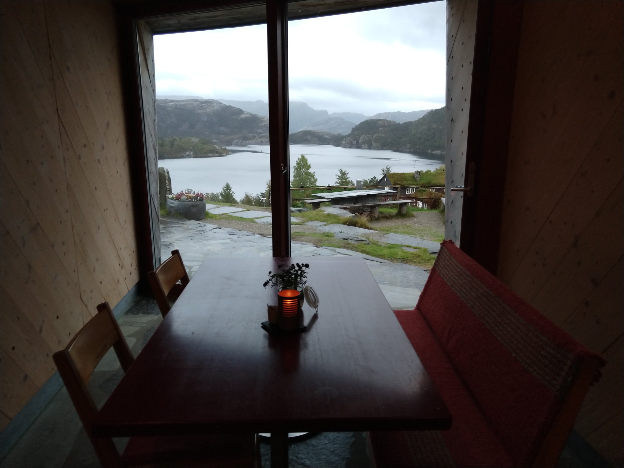
I decided to eat dinner and get some work done. I was able to sit here and do work as I saw a storm roll in.
I slept in the dorm building they had. Complete with bathrooms, showers, and a kitchen. My bed was in one of the 2 bunk rooms which had 11 beds. Tonight there was only 1 other person. He was a lovely gentleman by the name of Kelvin! He is a retired teacher from Hawaii who had some impressive magic tricks to show me.
In the morning we ate at the included breakfast buffet and then parted ways.
There were a couple hikes I could do on this day. I could hike that mountain that I passed the day before or I could go the opposite direction and go to a different spot against the fjord that, quoting a worker from the lodge, “has a similar view of the fjord without the crowds”. Instead I decided to hike a trail along the fjord for a few hours and then turnaround to catch the ferry back to Stavanger from Tau.
First, it’s worth noting that the trail starts about halfway down the Preikestolen trail. I actually missed the trail head and by the time I realized it, I just continued all the way to Preikestolen. Since I got an earlier start, there were less people. It was a different experience because the sun was in a different location and there were clouds.
For views of landscapes I actually prefer partly cloudy over clear sky. Below you can see an example of what I mean.

Bonus picture I got this day.

I turned around and found the trail I was originally aiming for. This trail was much different than the one to Preikestolen. The trail starts descending into a valley with a sign saying “STOP you are no longer on the trail to Preikestolen”. The trail is basically a stream down into a valley. I had to hop from rock to rock avoiding puddles. This was the point I realized that water proof hiking boots would have been really nice.

It was about 1 hour hiking down this valley that I realized I would have to hike back UP this valley. That didn’t sound too appealing to me.
That’s when I asked the question “what if I just didn’t turn around?”
I did a check of what stuff I had on me:
Food for multiple days
3 water bottles (and you can refill in streams here)
Rain gear (except water proof boots, whoops)
A map
GPS working on my phone
Portable battery for my phone
What I didn’t have was a sleeping bag or tent. So I knew I had to make it to a hostel.
The worker at Preikestolen lodge told me there was a ferry out of Songesand which was about a 6 hour hike. I also knew that there was lodging in that area in case I didn’t make the ferry. So that destination became my goal.
The hike was wonderful. I love getting away from tourists and just being alone out in nature. It’s worth noting that I was very confident about finding my way around. The map and GPS were very useful and I had phone service when I was high up. The one thing I had to be very careful about was not getting hurt. This is true at all times when hiking but especially so when you are alone because there is no one to send for help (112 is the emergency number in Norway).
Another way to not get lost is to always follow the trail markers. They are designated with a red ‘T’ and are very frequent.

The descent into the valley was only the first part of the hike. I quickly came to another peak which had amazing views of the fjord but without the tourists!

The hike continued in and out of the trees, against the fjord and also inland.
One of my favorite parts was hiking against a ridge that was right on the fjord. Good views down either side.

Looking left

Looking right
There were a couple hard parts of the hike. Multiple river/stream crossings where I had to try 3 or 4 different spots to get across. Again, these might have been easier with waterproof boots.
As well as parts where you have to hold onto a chain to climb/shimmy your way across some rocks.

I was getting quite exhausted and the weather was starting to turn on me.
The hike to this point was 11 miles over almost 10 total hours. This includes the detour to Preikestolen, a couple trail blazing excursions, and getting utterly exhausted by the end and having to stop frequently. I was actually moving for about 6 hours.

Using the Den Norske Turistforening (DNT) app, I showed up to a cabin in Bakken to get some sleep.
There were a limited number of beds that can be reserved. Over half of the beds are meant to be first come first served, which is what I relied on.
The cabin was also more well stocked than I anticipated. I expected a roof over my head and maybe a mattress. This cabin had a gas stove with plenty of fuel, kitchen supplies, beds, linens, pillows, and of course an out house! Water could be retrieved from the nearest stream.
The cabin is maintained by the people in the surrounding village community.
There was actually a locked house that could be reserved ahead of time. The cabin I stayed in was referred to as the “barn”. There is no lock and you keep the door closed with a rock.
The white building is the “house” and the wood and rocks on the right is the “barn”.

The hostel at Preikestolen had a fraction of it’s fill capacity. I thought I would be lucky to see one other person at a cabin like this one. Unfortunately for me, there was a group of 10 people from Holland that took over the entire cabin.
They initially told me I could stay in the stable out back. Yes, I couldn’t get into the house or barn, so I planned on sleeping in the stable and curling up in the hay where they originally kept the sheep.
Left building is the “barn”. Back right is the “stable”.

I actually imagined worse scenarios for how the night could end up so I knew I could tough it out for just one evening. Of course, I wasn’t going to sit alone in the dark stable twiddling my thumbs, so I stayed in the barn to socialize with my new Dutch friends.
After getting to know them for a bit, they seemed to loosen up with me. They eventually shifted people around and gave me one of the beds. They were also cooking burgers and fries and invited me to join!
Quite the turn of events. I went from sleeping in the sheep stable to getting a hot meal and a bed.
In the morning, I decided to do some research on this ferry that ran out of Songesand. I’m glad there was service (sometimes) because there is only 1 ferry per day (well it goes down the fjord and back so 2 possible pick ups) and it won’t stop at certain docks if no one books the ferry in advance. I booked my trip and headed to get picked up.
Here is the Strava from this portion of the hike, I stopped it about a mile in and forgot to restart it. But I want to show the pace I was going. Even after a nights rest, I was going pretty slow. 25:36/mi first mile the day before versus 35:05/mi this day. This was due to the trail difficulty. Half the time I was hopping from wet rock to wet rock.

This hike was along the coast, much closer to the water than the previous day.

I finally arrived at the dock with a couple hours to spare. There was a waiting area where I got some work done.

Turns out there is a “Songesand Camp and Café” here which has 9 beds for sleeping in addition to tent and RV camping. So this would have been a more traditional hostel situation if I had made it this far.
The ferry picked me up and we went to Lysebotn which is a town at the very end of the fjord. Then I just stayed on and rode the ferry all the way back out of the Fjord to a town called Lauvvik where I was able to get a bus back to Stavanger.


Seeing this fjord by ferry was amazing. I was able to see the places I hiked the days before. The fjord is pretty narrow, so you really get a good view of either side no matter where you are on the water.

Being on the water with the steep mountains and cliffs on either side was staggering. The fjord extends as far as you can see.
Waterfalls and picturesque villages line the sides. I felt like I was in a King Kong movie or somewhere in middle earth.


Here is a map of my total journey around the Stavanger area.

Here is some advice if you have ever thought of visiting Norway.
All in all I would say the fjords are an adventure absolutely worth experiencing, both by foot and by boat. Just be prepared for a good hike and wet weather. The trails are unforgiving but the views are absolutely worth it.
Also, if at all possible, come when the weather is good. Doing these hikes in the rain and wind would have been rough. The summer is the obvious choice but even then it still rains. I was fortunate enough to have the flexibility to choose the timing of these hikes for when the weather was going to be good (thank you 10 day forecast). You can’t even do these hikes November-April because of the snow. Some trails are open to snowshoe or cross country skiing.
Thanks again for reading my blog! I find it the best way to convey my thoughts and to transfer information from my brain to yours. The written word in combination with photos, gifs, and videos is better able to capture some of the emotions and highlights of the trip.
At the end of this post is a list of resources for such things as ferry, bus, and trail info.
Until next time!


Resources
Bergen to Stavanger ferry: https://www.fjordline.com/nb/p/ruter/bergen-stavanger-innenriks
Stavanger to Tau ferry: https://www.fjordnorway.com/planning-your-trip/getting-to-and-around/transport/ferry-stavanger-tau-p1437073
Hiking trails: https://www.komoot.com (I also bought a map at the Preikestolen lodge)
Lysefjord year around ferry: https://www.kolumbus.no/globalassets/ruter/baatruter/stavanger-lysebotn-kombibat.pdf
Lysefjord tourist cruise Jan-Sep: https://thefjords.no/files/documents/fjord-cruise-lysefjord-2018.pdf
#47 bus between Lauvvik and Sandnes: https://www.kolumbus.no/globalassets/ruter/bussruter/stavanger-sandnes-omegn/47-sandnes-sviland-lauvvik.pdf (I had to wait 2 hours between the Lysefjord ferry and this bus)
#2 bus between Sandnes and Stavanger is pretty frequent and using the Skyss app to pay for #47 should give you free transfer to the #2. You can also take the light rail from this area.